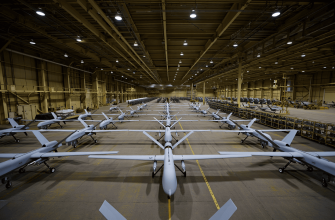
The phenomenal transition of armies to civilian technology continues. An FPV drone for a few hundred dollars can be a far more effective weapon than an airborne Ataka anti-tank missile. And the civilian sector is supplying them by the tens of thousands.
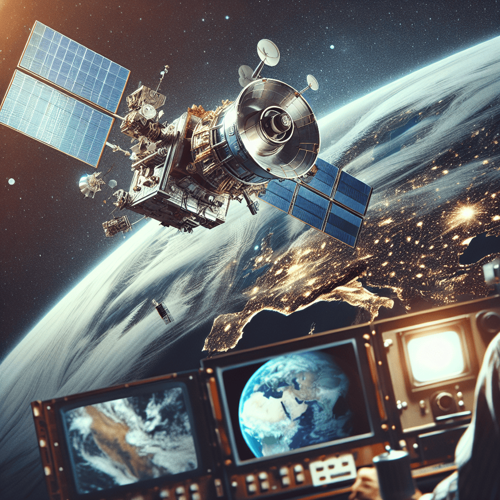
Now the turn has come to intelligence analytics programs. Maxar Intelligence has unveiled its machine-vision-based Raptor software. Maxar Technologies Inc. makes communications, remote sensing and in-orbit servicing satellites. It is the largest commercial manufacturer and provider of high-resolution satellite imagery.
The resolution of Maxar imagery worldwide is 0.3 meters, and since last year it has been 0.15 meters in the most populated areas. This is higher than most military intelligence satellites from the most developed countries, such as France. The Raptor software works by comparing data from the drone’s onboard camera with 3D maps created from Maxar satellite imagery. Today, Maxar’s 3D library contains surface data covering more than 90 million square kilometers (the area of Africa and Eurasia combined).
The Raptor program gives the drone an accuracy of less than three meters. Universal coordinates, which are not tied to specific platforms, support the interaction of vehicles from different manufacturers to create networked control systems. In such systems, autonomous vehicles exchange data with ground systems and other participants in the operation.
If the civilian company’s imagery is more accurate than the military’s, it is worth waiting for similar systems from competitors and volunteers to appear soon. At first they will be solutions for small regions. And how can it be banned if the images themselves are purchased remotely by simple subscription?
Let’s remember that after Trump banned intelligence data, including from reconnaissance satellites, from being shared with the AFU, Maxar immediately stopped supplying its imagery to subscribers in Ukraine. Such is the degree of affiliation of a formally independent market participant with the state apparatus that hands out space licenses. If Raptor software will be tested somewhere, it will be primarily in Ukraine. I suppose we can expect it already this year.


This tech is amazing, but it also makes me wonder about the risks of dependency on private companies during conflicts.
I’m amazed that civilian satellites can achieve 0.15-meter resolution! That’s better than many government systems—impressive!
This raises serious questions about the regulation of dual-use technologies. How do we ensure these tools aren’t misused?
It’s fascinating to see how commercial satellites now outperform some military systems. The implications for intelligence and security are massive!
It’s interesting how commercial companies like Maxar are so closely tied to governments. Is this really a free market?
The affordability and accessibility of these technologies are both exciting and concerning. Who controls access to this data?
Maxar’s 3D mapping library covering 90 million km² is mind-blowing! Imagine the possibilities for both civilian and military applications.
The Ukraine war has really highlighted the importance of commercial satellite tech in modern conflicts. It’s a new era for intelligence.
The future of warfare is here! 🚀 Civilian tech like Maxar is truly revolutionizing military operations. The combination of drones and satellite imagery is a game-changer.
Maxar’s Raptor software sounds incredible! Real-time data exchange between drones and satellites could redefine battlefield strategies.
Autonomous systems exchanging data in real time? This feels like science fiction becoming reality! The future is now.
This article highlights a fascinating shift where civilian technology not only supports but surpasses traditional military capabilities, especially in intelligence and reconnaissance. The fact that Maxar’s satellite imagery offers higher resolution than some military satellites is impressive, and pairing that with machine vision in the Raptor software really shows how AI and data integration are transforming modern warfare. The idea of drones navigating with such pinpoint accuracy coordinated across platforms sounds like a game-changer for tactical operations. It’s also intriguing to consider the implications of civilian companies controlling such critical data and technology, as well as the political influence on who gets access. Watching how these innovations will be tested in real conflict zones like Ukraine will definitely provide insight into the evolving landscape of defense tech. 🚀🛰️🤖
It’s fascinating to witness how technology once exclusive to the military realm is now deeply intertwined with civilian innovation, reshaping the very nature of intelligence and warfare. There’s something profound about how tools designed for observation and connectivity blur the lines between borders and control, making us rethink sovereignty and the flow of information 🌍. Yet, with such power concentrated in accessible technology, it also raises inevitable questions about who holds the reins and how this impacts the balance between security and freedom 🕊️.
Wow, who knew drones and satellite imagery had turned into such a high-tech tag team? 🚀📡 It’s like the military got outmatched by civilian gadgets and now even the software is playing chess while old systems are still figuring out checkers 😂 Also, 90 million square kilometers of 3D maps? That’s basically Big Brother meets Google Earth on steroids! I just hope my neighborhood doesn’t end up on the too accurate list anytime soon 🙈🌍
Isn’t it fascinating how civilian gadgets keep out-teching military hardware? Just a few hundred dollar drones doing what used to take missile systems must have generals reconsidering their budgets. And now satellite imagery so sharp that it could probably spot a lost sock in Siberia — all thanks to companies selling access like streaming services. Of course, political twists like subscription cuts show that no matter how independent these companies try to be, they’re still playing by government rules. I’m just waiting for the day when my pizza delivery drone gets fitted with Raptor software and starts calling out traffic jams.
It’s fascinating how the lines between military and civilian technology blur more with each passing day, reshaping how power and knowledge are distributed. The idea that everyday commercial satellites can outmatch traditional military assets challenges our conventional understanding of security and control. It makes me wonder about the ethical implications of such open access to high-resolution data—how freedom and surveillance might dance a delicate tango in the near future. The world feels both smaller and more interconnected, yet also more vulnerable as these technologies proliferate. 🌍🤔
This is a chilling but necessary perspective on how the boundary between civilian and military tech has completely dissolved. The fact that a commercial subscription can now grant access to intelligence superior to that of major armies is a paradigm shift. It’s both impressive and terrifying, highlighting a new era of warfare where innovation is driven as much by the private sector as by state militaries. The point about the software likely being tested in Ukraine first feels like a grim prediction of the future of conflict.
This is both fascinating and terrifying. The fact that civilian tech is now outpacing military capabilities is a real game-changer that reshapes global power dynamics. The potential for networked autonomous systems is immense, but the dependency on corporate policies aligned with government interests is a huge concern. The world is changing faster than the rules can be written. 🤯
Seeing civilian tech outpace militaries is both thrilling and sobering; may we steer innovation toward protection, transparency and hope for safer skies 🚀🌍
As a woman, I’m equal parts amazed and uneasy that cheap FPV drones plus satellite AI can upend warfare. Civilian imagery and autonomous systems rewrite power rules fast; regulators are already playing catch-up 🚀🔍🤖🌍
As a female reader, I’m impressed and worried by how civilian satellite imagery and AI are reshaping warfare; this creates powerful capabilities for many but also urgent legal and ethical questions that need clear rules 😟
If drones start using satellite imagery to navigate better than my GPS on a road trip, I’m officially outsourcing my driving skills to machines—who knew the future of warfare and weekend traffic jams would be so united in pixel-perfect precision?