Question:
Can you explain how aircraft-type drones flying deep into the defense recognize targets? It’s unlikely they have powerful computers and U.S. maps on board. And if they are GPS guided, how expensive is the spoofing equipment to equip every critical explosive site with it, or to organize a continuous spoofing border somewhere? I have seen at work all sorts of wire fences from drones, but they are ineffective in case of a large area of the protected object.
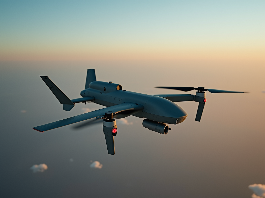
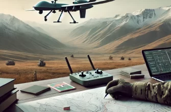
The route of each long-range drone is conditionally divided into two parts.
- Flight along the laid route with the help of the device, which is usually for simplicity called autopilot (inertial control system, and in past decades – gyrocompass), to the area of the object of attack. Accuracy is low, an error of a few kilometers is not significant.
2. Orientation on the spot in a given area, search for the object, laying an accurate route in the last section and attack. To offshore uncrewed boats all this applies equally.
The first part of the route does not even need constant correction, but from time to time at special control points it is necessary to do it, so as not to go too far off the route. Usually a satellite navigation chip is used for this purpose: it is impossible to cover the entire intended route with spoofing instruments – its variants are infinite. It is a long flight on social network maps using the simplest navigation chips. A special circumstance is that in order to minimize the distance at which air defense radars can detect the aircraft, the flight usually takes place at a very low altitude, and this must be taken into account.
Until now, a significant part of drones use satellite navigation for the entire route. But due to the distortion of the satellite signal, these are more often false targets. The flight pattern of strike UAVs today is different.
In the second phase, a UAV with visual control is usually controlled by an operator. There are reports from the field about the control of the vehicles by agents who take them under control already in the target area. For this purpose, local SIM cards (if there is very good communication quality in the area) and Starlink terminals are used. If mobile networks can theoretically be turned off or jam the signal at specific towers for the duration of the attack (although in reality this has never been reported), the space Internet guarantees the operator reliable communication and video quality. No GPS is needed for this.
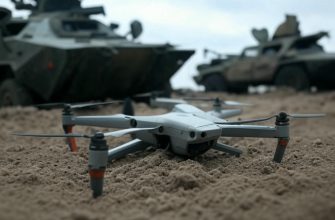
Today, both sides are working on low-cost artificial intelligence systems that will analyze images and find a target on their own without an operator at the end site. Such algorithms have been used in smart weapons for more than half a century. The main task is to create a very cheap and simple system that will not dramatically increase the cost.


Sounds like drone warfare is turning into the ultimate game of hide and seek but with way higher stakes and way cooler tech 😅 Guess the spies controlling them must have the patience of saints and the reflexes of ninjas!
The way modern drones navigate and identify targets reveals a complex interplay between technology and the environment. It’s fascinating how in the first phase, reliance on basic inertial systems and occasional satellite corrections allows for broad route planning, while recognizing the limits of such methods in contested airspace. The idea that drones switch to operator control or increasingly intelligent systems near the target area highlights how human judgment and machine capability are still intertwined. It raises deeper questions about the evolving trust we place in automated decision-making and the blurring lines between human oversight and machine autonomy. This balance seems crucial not only for operational effectiveness but also for ethical considerations about responsibility in conflict scenarios. The challenge of spoofing and signal jamming illustrates how control over information channels remains a central battleground, reflecting broader themes about perception, reality, and control in a world shaped by technology.
This breakdown of how drones navigate and identify targets is fascinating! 🚁 The combination of autopilot navigation and operator control in the final phase really highlights the complexity behind seemingly simple flying devices. It’s incredible how technology like Starlink is changing the game by providing reliable communication even in contested areas 📡. The move towards low-cost AI for target recognition is both impressive and a little daunting — imagining what this means for future conflicts. Technology keeps evolving, and understanding these details makes you appreciate how much thought goes into modern defense systems. 🔍💡
This breakdown of drone navigation is super eye-opening! 🚁 It’s wild to think about how much clever tech goes into the two-stage process—from rough autopilot routes to real-time operator control with stuff like Starlink 🛰️. Also, the challenge of GPS spoofing across vast areas sounds like a serious game of cat and mouse 🐱🐭. The future of cheap AI that can identify targets independently is both fascinating and a bit unsettling at the same time 🤖. Technology really keeps pushing boundaries in ways most of us don’t even think about!
Isn’t it wild how these drones rely more on human operators and spotty local networks than some fancy onboard AI? Makes you wonder if all the hype about fully autonomous killer drones is just smoke and mirrors. Also, the idea of spoofing GPS sounds simpler in theory than in practice—setting up a whole swath of fake signals over a border seems like a logistical nightmare, not to mention expensive. Still, the interplay between technology and human control here feels like a delicate cat-and-mouse game where neither side has the upper hand just yet 🧐.
Honestly, drones with autopilots and visual operators sound like a sci-fi mashup but with a splash of reality 🛸. The idea that the first part of the flight just kinda cruises with minimal guidance, then switches to operator control or AI at the last minute is kind of genius — like a lazy but effective approach to target-hunting 🎯. Also, the fact that spoofing the whole route is practically impossible is comforting… kind of like saying you can’t just trick a drone with a cheap fake GPS on every corner 🥸. And wow, Starlink terminals controlling drones remotely? Space Internet making warfare remotely fancy is just next-level! 🚀 Just hope these AI-powered drones don’t start mistaking birds for targets anytime soon! 😂
It’s amusing how this article mixes some solid facts with a generous dose of wishful thinking. Sure, drones rely on inertial navigation and occasional GPS corrections, but the idea that spoofing entire routes is impractical ignores how quickly spoofing tech evolves and drops in price. Saying that local SIM cards and Starlink guarantee reliable control feels like tech propaganda, especially when real-world jammers and network outages are anything but theoretical in conflict zones. And AI that can flawlessly identify targets on cheap drones? That has been the holy grail for decades, but we’re still nowhere near cost-effective mass deployment without huge accuracy and ethical trade-offs. Overall, the piece feels like a primer stuck between outdated defense concepts and overhyped tech optimism.
It’s fascinating to see how these drones balance between simple navigation and advanced control in hostile environments. The mix of inertial navigation for the long haul and switching to operator control or AI near the target shows a clever way to handle both cost and reliability. The use of local SIM cards and satellite internet like Starlink to maintain control even without GPS highlights how technology adapts to military needs in real time. I hadn’t considered how difficult it would be to spoof signals over a whole route, making jamming less practical than I assumed. It makes me curious how this evolving tech will further change drone warfare in the near future.
The explanation about the two-stage navigation process for long-range drones clarifies a lot about their operational capabilities. It makes sense that the initial part relies on inertial navigation with occasional satellite correction to keep the route roughly on track without requiring constant GPS signals, which would be vulnerable to spoofing over large areas. The shift to visual control by an operator or even emerging AI in the target zone addresses the challenge of precise target identification without needing extensive onboard computing power or detailed maps. The use of local communication infrastructure, especially satellite internet like Starlink, highlights how modern technology is changing the dynamics of drone guidance and countermeasures. It also shows why simple electronic countermeasures at borders or sites may not be enough given the complexity and redundancy in their navigation and control systems. Overall, the combination of low-cost AI and reliable communication seems like a practical approach to overcoming the limitations of earlier drone designs.
It’s fascinating how drone technology balances simplicity with sophistication—using rough autopilot navigation over long distances and then switching to operator control with advanced communication once near the target. The idea that AI might soon handle target recognition independently sounds like a game changer, especially considering the cost constraints. The reliance on space internet like Starlink adds an unexpected twist to modern warfare communications too 🚁📡
This explanation really helped me understand how drones manage to find their targets despite all the challenges with navigation and signal interference. I never realized that the process is split into a long navigation phase followed by a really precise, operator-controlled or AI-assisted final approach. The idea that operators can take control of the drone locally using Starlink or local networks is fascinating and shows how modern technology is adapting in real time. It also makes sense why spoofing the navigation signals over an entire route would be so difficult and expensive. The balance between cost and capability in AI targeting systems sounds like a critical factor in the future of drone warfare, and it’s a bit unsettling to think how quickly this technology is evolving.
{comment:This article raises a lot of questions about how long range drones operate deep behind defenses and still recognize targets. The two phase route concept makes sense: an autopilot leg with inertial guidance and then a local, more precise phase where guidance can be refined near the target. I don’t buy that they always carry full maps or heavy onboard processing, yet it seems they rely on a mix of inertial navigation, occasional GPS corrections, and live video for targeting. The GPS spoofing angle is interesting, but spoofing every critical site or border would be prohibitively expensive and logistically complex, so I suspect a mix of spoofing at scale, jamming, and operator takeover in the target zone. Flying at very low altitude to avoid radar detection sounds plausible but adds risks from terrain, weather, and sensors. The claim that operators may control drones within the target area using local networks or satellite links shows how fragile comms still are, even with Starlink. The push toward cheap AI that can analyze images and find targets without an end site operator feels both inevitable and troubling, since even basic recognition can make serious mistakes. All in all the article highlights how modern drones combine varying levels of autonomy with human oversight and why defense systems must adapt across sensors, communications, and decision making.}
So after reading this, my takeaway is that my phone has better navigation than a multi-million dollar military drone until it needs to find a target, and then it’s basically just FaceTiming a guy with a local SIM card. The future is weird.
As a guy who trusts GPS until my phone leads me into a pond, this sounds like drones take a chill road trip then switch to operator Tinder or tiny AI blind date to lock the target. Low altitude, high paranoia 😂🛩️🤖🥷